
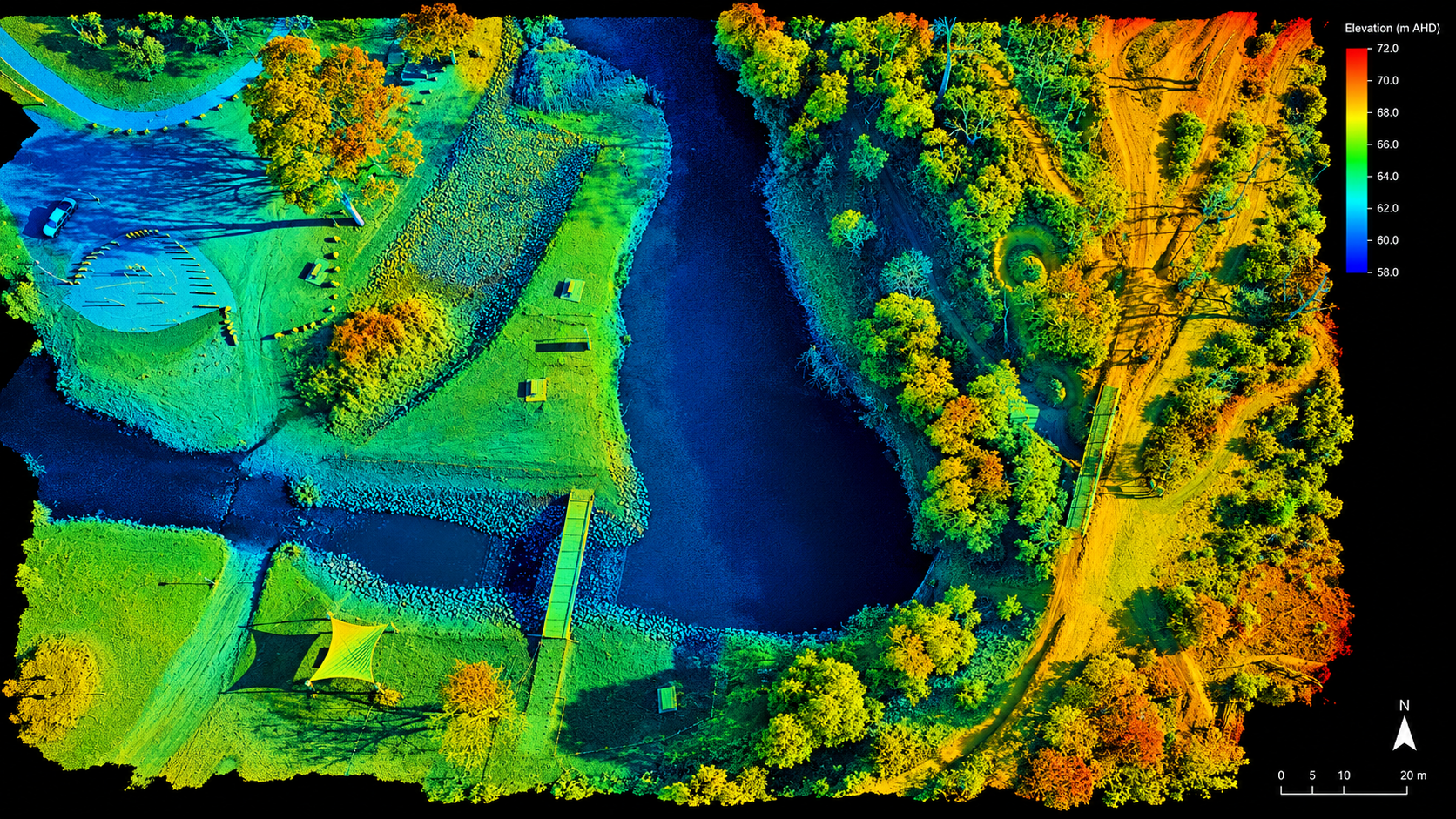
LiDAR survey & terrain intelligence
Three-dimensional terrain and vegetation intelligence for complex sites and decisions.
Built for real operating conditions
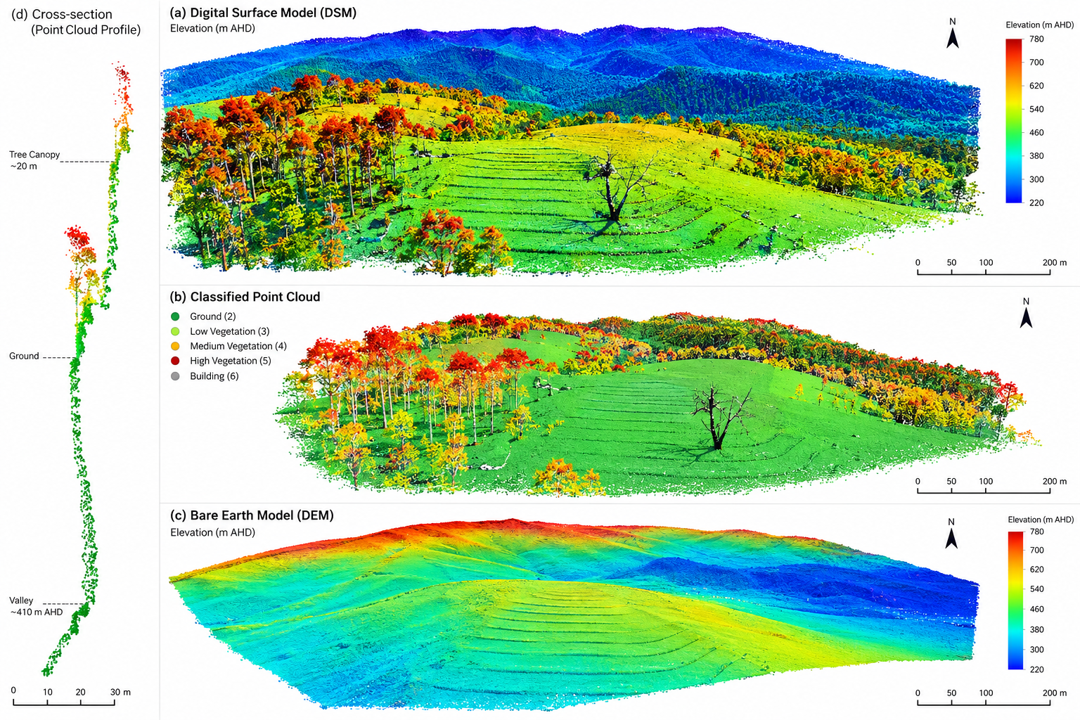
LiDAR captures accurate three-dimensional data across complex landscapes. It can measure vegetation structure and identify ground surfaces beneath canopy where conventional aerial imagery is limited.
The resulting terrain, surface and vegetation models support environmental work, plantation design, earthworks, water planning, biomass assessment and property-scale decision making.
LiDAR capability
Environmental and carbon project planning
Plantation design and establishment
Digital Terrain and Surface Models
Contour, terrain and slope analysis
Drainage and water flow assessment
Earthworks planning and volumetric calculations
Vegetation structure and canopy analysis
Forest inventory and biomass assessment
Erosion assessment
Property and farm planning
Asset and infrastructure mapping
GIS data collection and management
Need this capability on your project?
Tell us about the site, timing and outcome you need.